It’s been a while since I’ve written a blog. I’m rusty. Time to talk about snow.
Have you ever wondered why it is snowing in Austin, Texas, at a latitude of 30.3°N while the ground is bare and ordinary in Bellingham, Washington, at a latitude of 48.8°N? Have you ever wondered why some years we can go all winter with hardly a flake in the air and others we can get a month straight of frigid cold and snow? Have you ever wondered about that sudden strong, dry wind that seems to come from an unusual direction at the start of colder weather? Have you ever needed a reason to get angry at the Pacific Ocean? Maybe not the last one.
These questions are the ones I want to explore today and it’s partially because we are a week out from a potential manifestation of what we will discuss.
Disclaimer: I am a part of a weather group on Facebook that has revealed to me that I know almost nothing about the dynamics that produce cold and snow in our region. But I know just enough to tell most of my 20 readers something they don’t know. If your reaction to this blog is “Oh… cool,” then I’ve fulfilled my calling in life. Nothing gives me greater joy.
What do you need for it to snow? Simple enough. Precipitation and cold air. The frustration of being a snow fanatic in the Pacific Northwest is that we kind of always have both precipitation and cold during the winter. It’s just never quite cold enough. Bellingham’s average temperature from late November to the end of February hovers right around 39°F. That’s 7 measly degrees above freezing. It’s a sad, stark reality. But still, you might ask, why doesn’t it at least snow more often if our average temperature is so close?
I have 6 words for you. Pacific Ocean, westerly flow, mountain ranges.
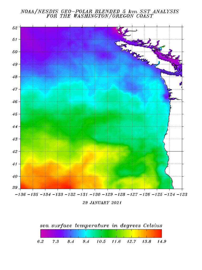
First, the Pacific Ocean. You may have never run into the Pacific Ocean on a PNW beach and thought, “Oh, that’s warm,” but relatively speaking, it’s quite warm. Below is the current temperature of the eastern Pacific Ocean along the PNW coast. Temperatures are in Celsius, so to translate- the surface waters are somewhere around 45°F. That’s a very similar temperature to a typical rainy day in the PNW.
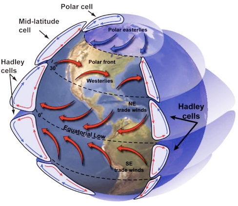
Second, westerly flow (or winds that travel from west to east). We are smack-dab in the middle of the mid-latitudes (30°N-60°N), where winds typically travel from the west to east. See the map below.
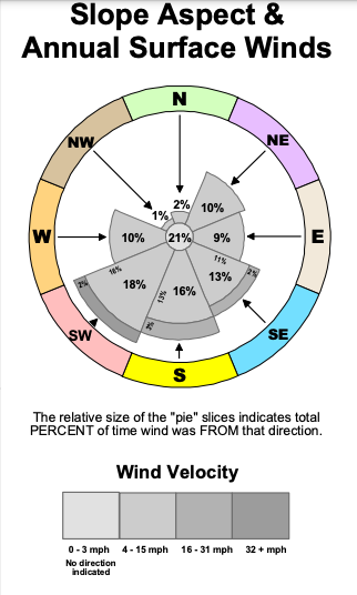
Over the whole Pacific Northwest, the most common wind direction is from the southwest. See below.
Well, what is to our west? That pesky Pacific Ocean. The Pacific Ocean is the primary culprit for the average PNW day- light rain, undefined gray clouds, 44°F.
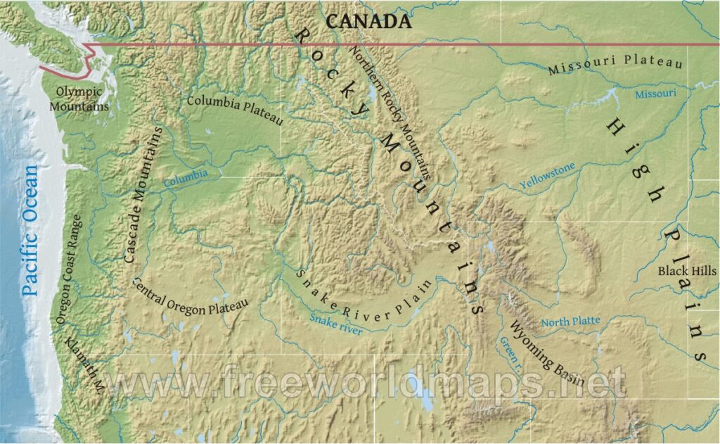
Third, mountain ranges. Have you ever seen a forecast for, say, North Dakota (the same latitude as us) in January, where the high will be -10°F? Bismarck, North Dakota is only 1,686 feet in elevation, yet it rarely gets even close to 0°F at some of our ski resorts. That’s because there is frigid continental air to our east. Now, I said that the constant wind regime is westerly over us, but that doesn’t mean that cold continental air wouldn’t want to travel from the east or north towards us from time to time. The problem is that several mountain ranges block us- the Rocky Mountains and the Cascade Mountains in particular. And cold air is dense, meaning it doesn’t like to just dance over 4,000+ foot plus barriers.
So, the westerly flow that carries air over relatively mild surface waters for thousands of miles creates our mundane, cool, but not too cold, typical PNW weather. It kind of feels like everything seems to be working against us. Fortunately, some kinks in the Cascade armor and some anomalies in the upper atmosphere can give us just the right dynamics for cold and snow.
I’m going to give you an image, and then I’ll explain it.
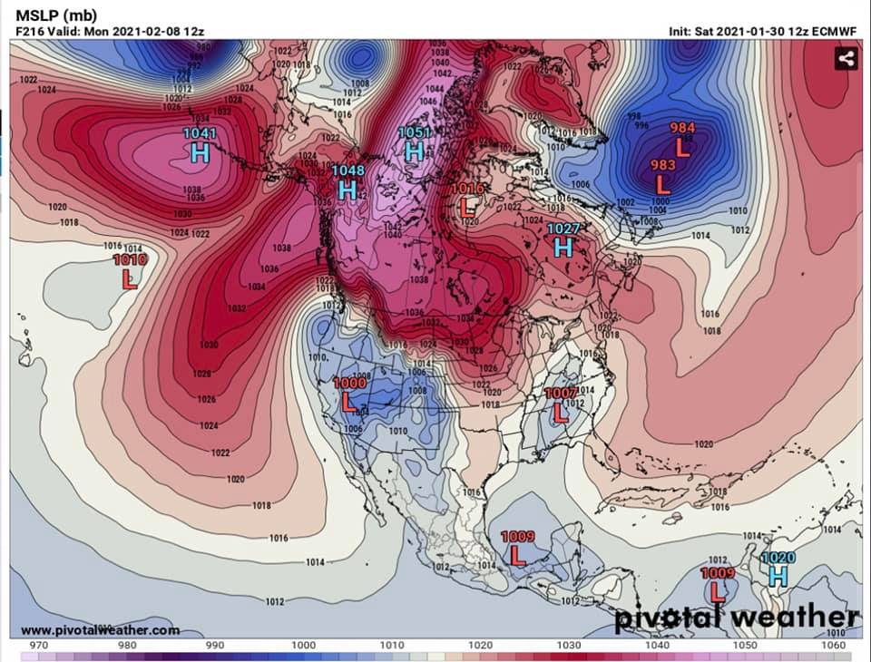
This is pretty golden. By the way, this is what one weather model is predicting for Monday, February 8. So, what are we looking at? This shows the difference in pressure in the upper atmosphere from average. Put very simply…
Imagine, if air is moving downward where will it want to go when it hits the surface and can no longer move downward? Well, probably in all directions, but where might it most easily go? Towards the area where the air is moving upward (low pressure) since that’s the area of least resistance.
Looking at the map above, you may notice that high pressure (red colors) is to the north and east, where it’s quite a bit colder in the winter (you may also notice a huge red area to the west- I’ll explain its role in a moment). You may also notice the little distinct blue circle along the north-central Oregon Coast. This creates a very unique set up where the winds actually want to travel from the east toward the west, and often at a pretty forceful, determined speed.
So, what about those mountains blocking us from the colder air to the east and north? There are 2 essential kinks: the Columbia Gorge and the Frasier River Valley.
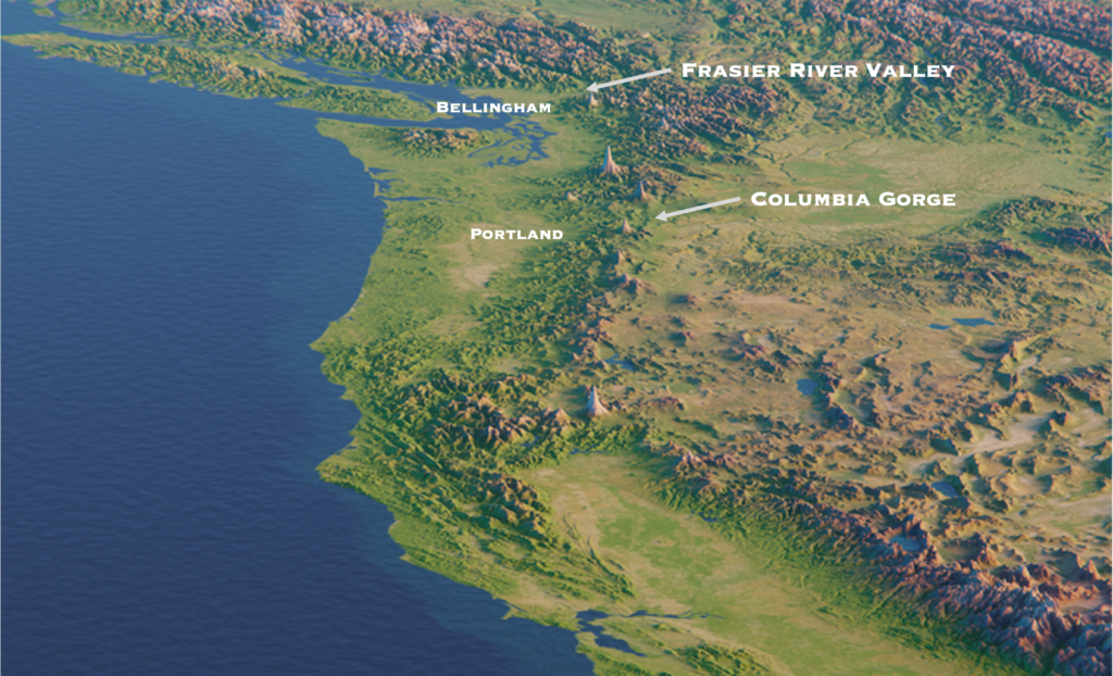
When the upper atmospheric ingredients are just right (i.e., the ingredients shown in the map above), these gaps in the mountains allow that colder continental air to our east to pool up and then flow right into our neck of the woods.
As for precipitation, low pressure often brings with it the moisture we need. That’s why the scenario shown in the image above is pretty perfect (at least for the Portland and SW Washington area). Precipitation wraps south around the low-pressure system center and then heads to the northeast of that low. As the upper atmospheric dynamics result in colder air filtering through those gaps in the mountains, the low-pressure system’s precipitation runs over the top, dropping moisture into the relatively cold environment. If the low-pressure system is too strong, it will turn the winds westerly, and we’ll get that mild Pacific Ocean air mass. If it’s too weak, we may get the cold but not enough precipitation to reach the surface. Hopefully, you are beginning to see why the ingredients for cold and snow are so challenging to come by here in the PNW.
Lastly, what about that big red area to our west? Our biggest dilemma for getting snow is the constant westerly flow. It’s like a river of relatively warm air that never stops flowing over us. But, when we get high pressure over the central/eastern Pacific Ocean, it blocks the westerly flow (it’s often called an Aleutian Block), working much like a dam. This allows the cold air to stick around for a while, rather than creating a one-and-done setup.
I find snow in the PNW to be pretty amazing because it often results from atmospheric dynamics happening as far north as the north pole, as far west as the central Pacific, as far east as eastern Canada, and as far south as northern California, all in one day. A lot is going on.
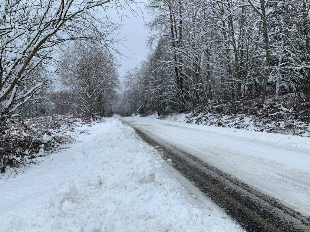
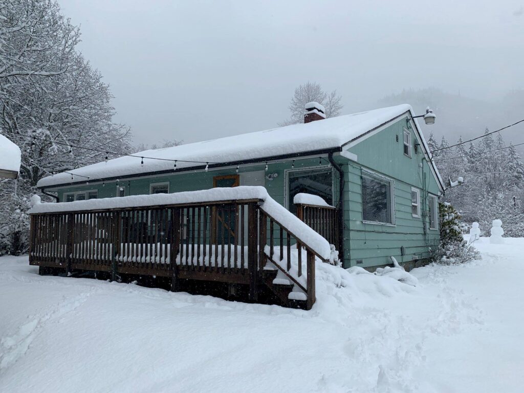
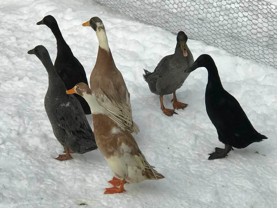
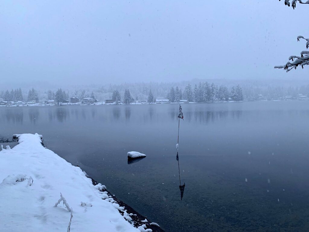
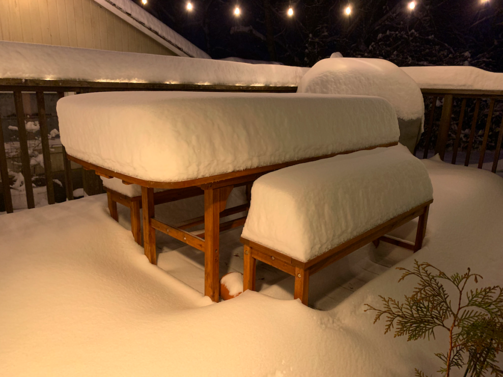
To close- some favorite pictures…
Dooie Bennett
February 1, 2021 | 4:33 pm
Jack! You put the so called meteorologists to shame. I guarantee they couldn’t explain anything like you do. Fantastic!
Taylor
February 3, 2021 | 1:17 am
This is awesome Jack! Great follow up to our conversation the other day 🙂